Crude rendering realized with CloudCompare point cloud processing software
Crude rendering realized with CloudCompare point cloud
processing software
The original 3D lasergrammetric data (refer below to the Exp-Cloud-ELAPHS-94M.laz file), offered for download in this site, was acquired during an EDYTEM / USMB / CNRS joint project and, as such, is copyrighted by EDYTEM / USMB / CNRS. Contact: Stephane Jaillet.
All data contained within this directory are released under the ETALAB v2.0 open license (refer to file ETALAB-Licence-Ouverte-v2.0_EN.pdf within this directory).
A reference concerning the "Creux des Elaphes" site is the article Philippe M., Chaix L., Guibot S., Hobléa F., Jeannet M., Valli A. 2001 : Le Creux des Élaphes (Commune des Déserts, Plateau du Revard, Savoie) et sa faune de vertébrés holocènes, Cahiers scientifiques du Muséum d’histoire naturelle de Lyon, 2, p. 19-105.
The abstract of the first section of this article (The site, its discovery and realized searches, pp. 21-29), mentions
The creux des Elaphes is a small natural cave in the Bauges Massif (Savoie, France). When it was discovered, in May 1994, the inventor was surprised by the presence of numerous bones [...] especially a skull and some important elements of the skeleton of a red deer (Cervus elaphus), hence the name of this cave.
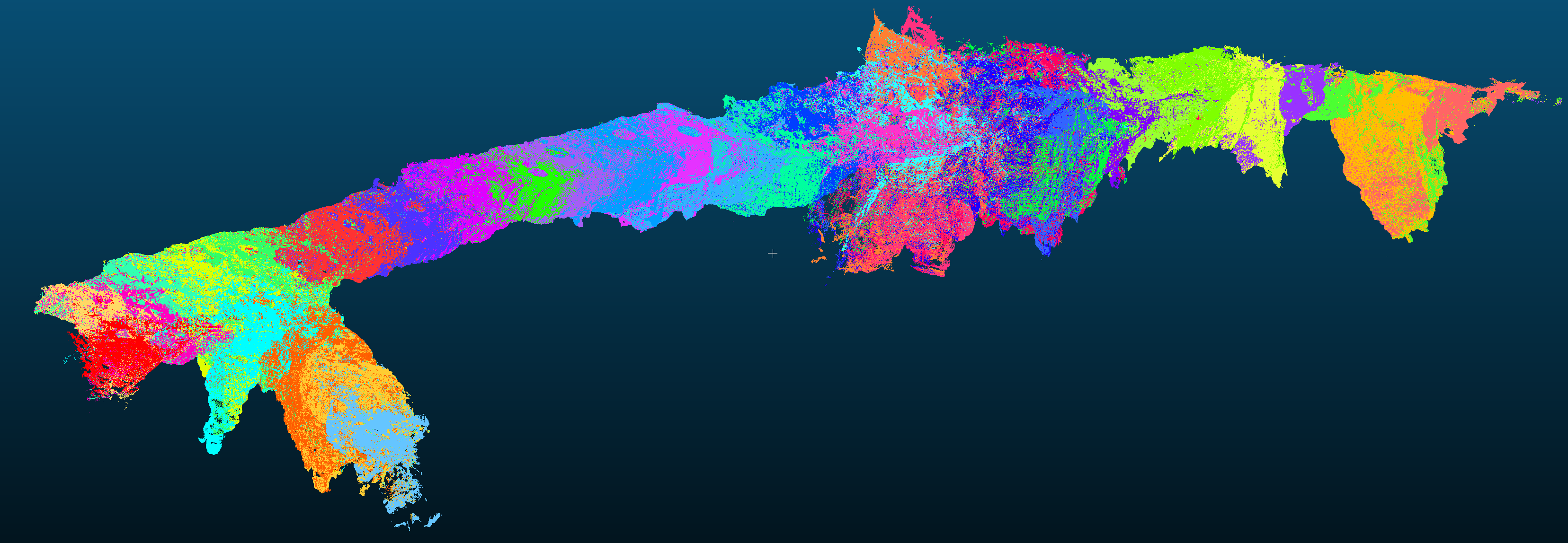
The original lasergrammetric (LIDAR Aerial Survey) point cloud data holds 94 465 067 RGB 3D points. It is available under different formats
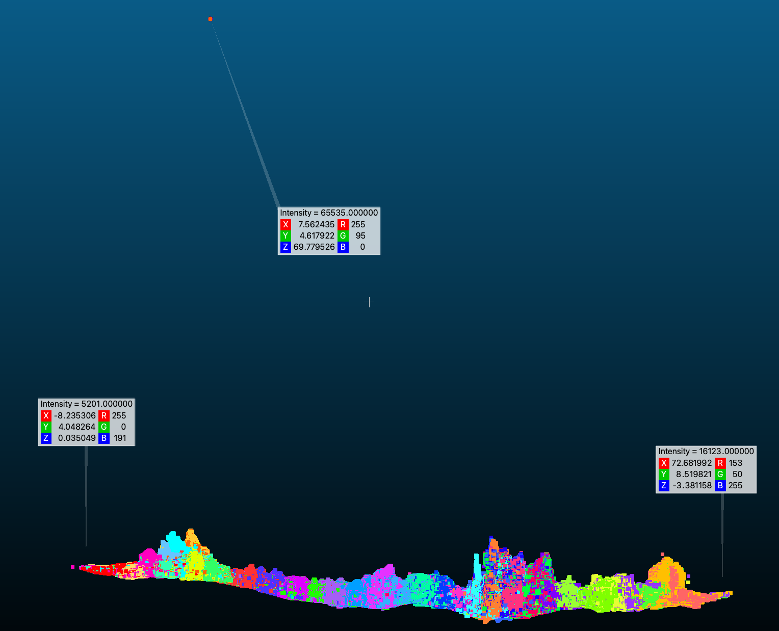
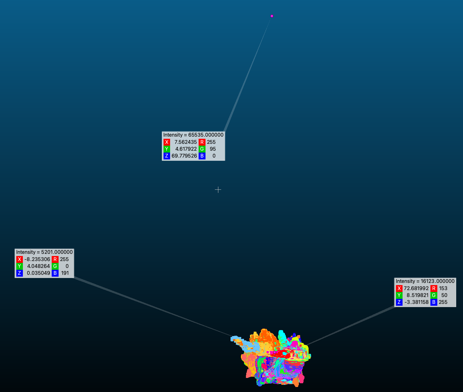
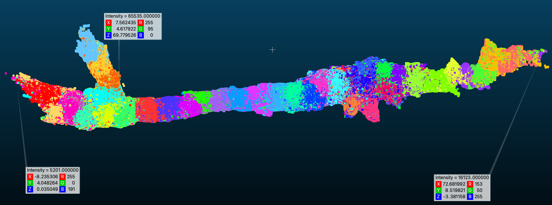
The original 3D lasergrammetric data Exp-Cloud-ELAPHS-94M.laz file has some aquisition artefacts: a small set of isolated points stading aside from the cave geometry. This glitch can be seen e.g. with CloudCompare as depicted in the following views.
|
|
| Z axis is up, X points to the right of the screen and Y is perpendicular to the screen | Z axis is up, Y points to the right of the screen and X is perpendicular to the screen |
Y axis is up, X points to the right of the screen and Z is perpendicular to
the screen
Altough this glitch doesn't prevent working on the point cloud (starting with displaying them), the bounding box is quite offseted from the barycenter of the point cloud which can perturb the manipulation of the point cloud (rotations) or even the display within some applications.
Sanitizations thus just consists in removing those three offseted points.
3dTiles format does not allow to specify a CRS (Coordinate Reference System). Different geographical placements (or positionnings) are thus offered depending on the main "tileset.json" entrypoint that you consider. In other terms the only difference between the following different entrypoints